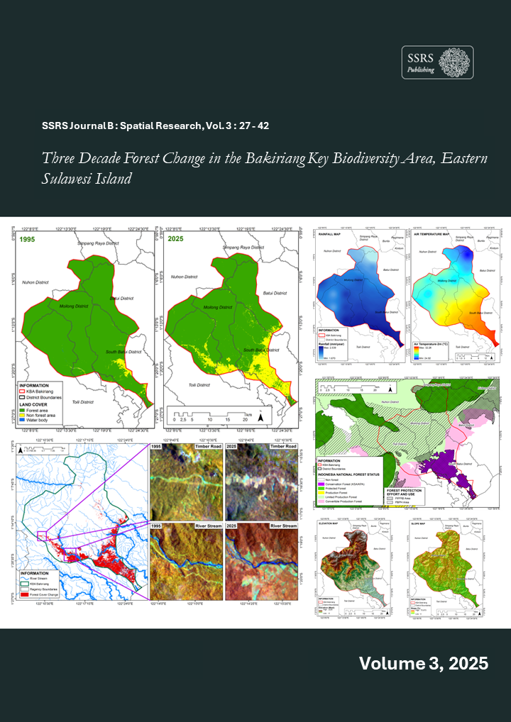
Three Decade Forest Change in the Bakiriang Key Biodiversity Area, Eastern Sulawesi Island
Kata Kunci:
Bakiriang KBAs, Landsat, Species, SulawesiAbstrak
The Bakiriang Key Biodiversity Areas (KBAs) on the island of Sulawesi are one of the global biodiversity landscapes identified for species conservation and the provision of critical habitats for endemic and rare species on the island of Sulawesi. However, these KBAs have experienced forest fragmentation due to the expansion of smallholder agriculture and large-scale plantations. Information regarding forest loss within the KBAs on Sulawesi Island remains very limited, necessitating a spatial assessment of forest loss. Therefore, in this study, we used Landsat-5 and Landsat-8-9 satellite imagery to map forest cover in 1995 and 2025. Geospatial analysis of the Landsat imagery was conducted using the Google Earth Engine (GEE) geospatial platform and the random forest classification algorithm. The results show a decrease in forest area of 9,155.16 ha, or approximately 12.56%, between 1995 and 2025, with a rate of decline reaching 305.17 ha/year (-0.42%). In terms of spatial patterns, changes in forest cover are distributed along the direction of the river toward its headwaters, with elevations reaching 160.41 ± 148.91 meters above sea level. Under the protection of the national forest policy, 5,381.10 ha of forest cover has been damaged within the Bakiriang Wildlife Reserve conservation area, leaving 5,495.67 ha of forest cover remaining by 2025. This indicates a lack of role and effectiveness of conservation areas in protecting forest cover within the Bakiriang KBAs, which shelter several endemic and rare species. Landscape rehabilitation of the Bakiriang KBAs through agroforestry systems in non-protected areas is recommended to enhance ecosystem functions for the habitats of key species within the KBAs.