Hotspot Distribution Assessment on The Peat Hydrological Unit (PHU) in Riau Province
Kata Kunci:
monitoring, peatland ecosystem, tropical forest fireAbstrak
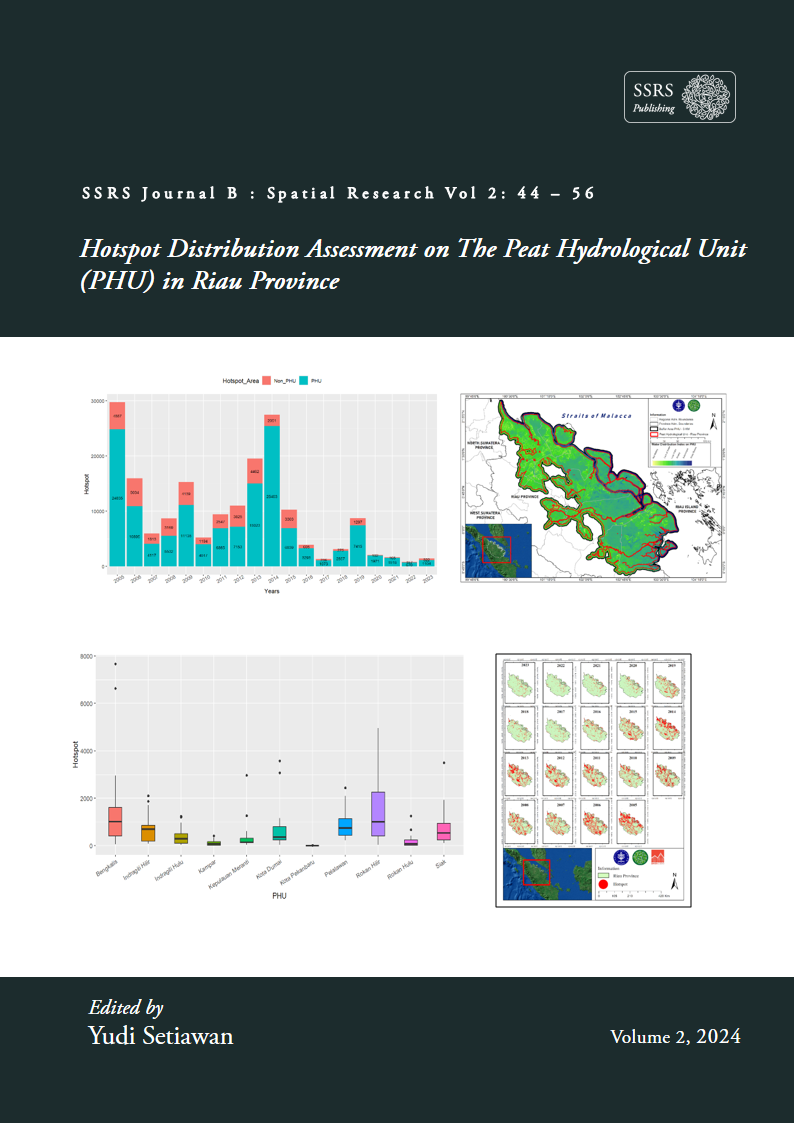
Indonesia is the third country with the largest tropical forest area in the world after Brazil and Congo. However, as time goes by the area of forest in Indonesia is decreasing. One of the dominant causes of forest destruction in Indonesia is forest fires. The type of forest that is frequently and susceptible to forest fires is forest on peatlands. Monitoring the distribution of hotspots is an important strategy in preventing forest fires on peatlands. Therefore, this research was carried out to design a platform for monitoring forest and land fires in forests on peatlands using a case study location in Riau Province. This monitoring platform utilizes remote sensing technology which uses NASA FIRMS MODIS hotspot data, BMKG rainfall data, and Sentinel-2 hydrology data. During the period 2005-2023, the most hotspots were found in 2005-2015, while the fewest hotspots were found in 2016-2023. The accumulated hotspot data is found in peat soil (PHU) as many as 138,523 hotspot (77.8%), while in mineral soil (non PHU) there are 39,583 points (22.2%). Riau Province, especially Rokan Hilir, Bengkalis and Pelalawan Regencies, are districts that require special attention in efforts to prevent forest and peatland fires because they have been detected to have the largest distribution of hotspots.