Monitoring Spatiotemporal Changes of Limboto’s Lake Condition Using Sentinel-II MSI Images Based on Google Earth Engine (GEE).
Kata Kunci:
Limboto's Lake, GEE, Turbidity, ConservationAbstrak
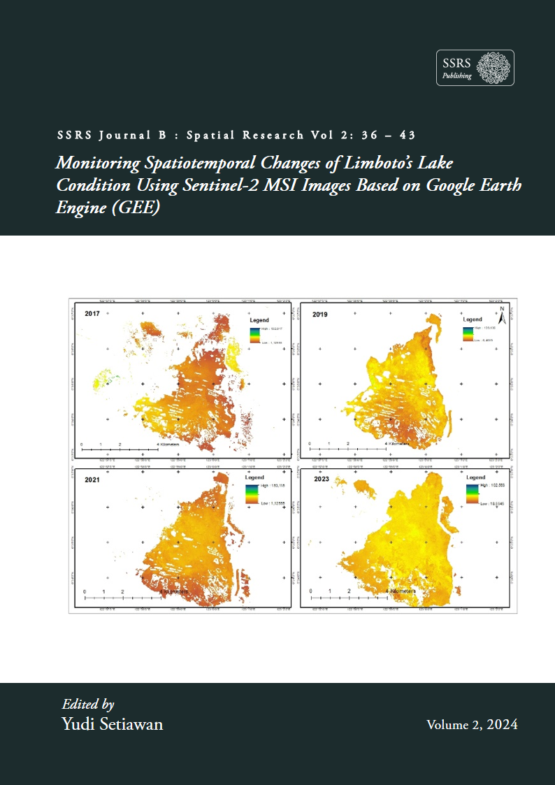
Lake Limboto is the largest lake in Gorontalo Province and is a critical lake prioritized for recovery (National Priority Lake). The criticality of Lake Limboto is influenced by various surrounding land use activities that affect the lake's water quality through runoff and possible pollution from domestic waste from surrounding settlements. Changes in the water quality of Lake Limboto are essential for spatial assessment using remote sensing data for efficient periodic monitoring. Spatiotemporal monitoring of Lake Limboto's condition was conducted using Sentinel-2 MSI (MultiSpectral Instrument) satellite imagery and involving the Random Forest (RF) machine learning classification method. RF classification was carried out by mapping water and non-water cover in the 2017 - 2023 timeframe and obtained a classification accuracy of 0.93 (kappa). Based on the monitoring of lake water conditions, the distribution of turbidity in 2017, 2019, 2021, and 2023. Lake water quality in 2017 with dirty water condition class had an area of 0.45 ha and decreased in 2019 (0.04 ha), 2021 (0.03 ha) and 2023 (0.03 ha). The increase in lake water quality and the expansion of water cover in Lake Limboto during the study period indicate the success of lake recovery. It is hoped that this research can be used as a basis for decision-making for protecting the Limboto Lake area.