Urban Forest Distribution in Metropolitan City at Java Island: A Study of the Application of Google Earth Engine Geospatial Technology
Keywords:
Goespatial technology, Java Island, Metropolitan city, Urban forestAbstract
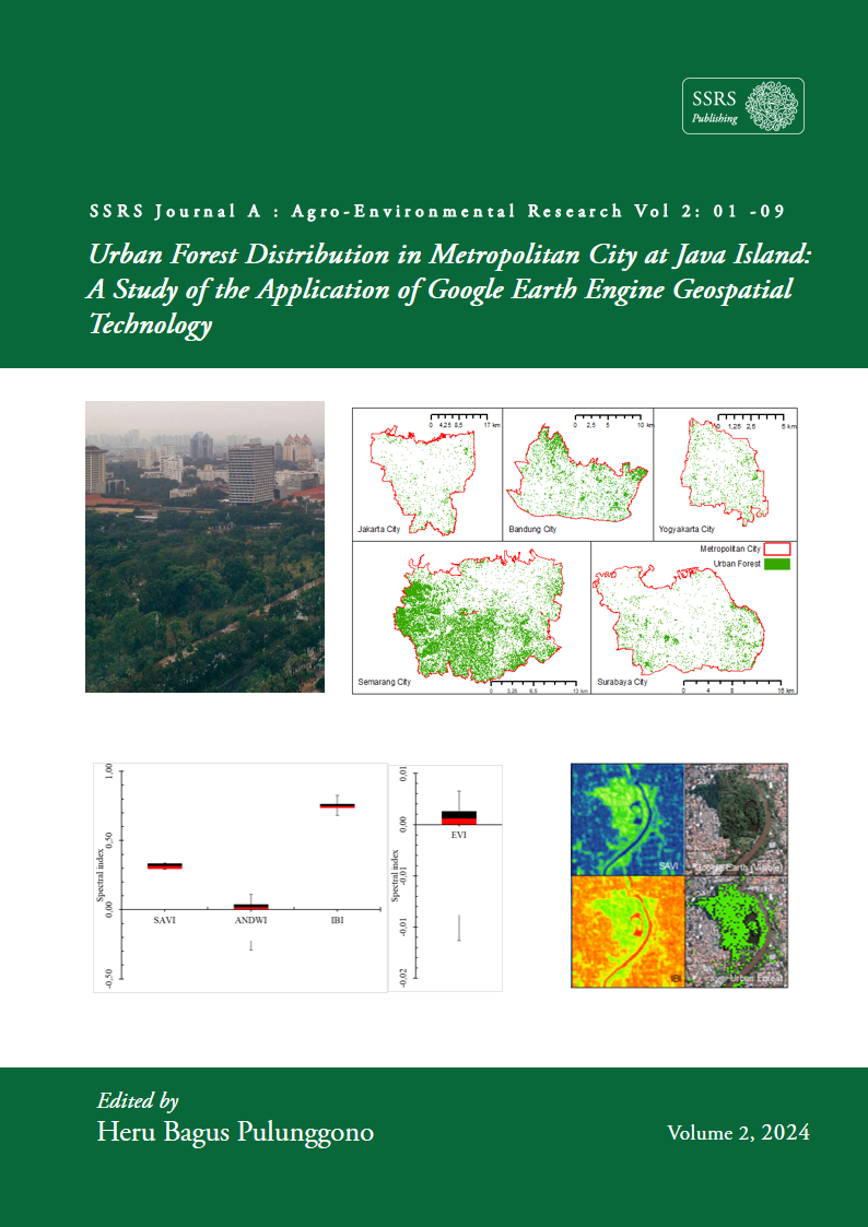
Google Earth Engine (GEE) is a geospatial technology based on cloud computing that has various advantages compared to manual software. Data usage on this platform is integrated with free-access satellite imagery data sources such as ESA's Sentinel-2 Multispectral Instrument (MSI) imagery. In addition, the ability to run a combination of index algorithms (vegetation, water, and built land indices) and Random Forest (RF) classification algorithms can help detect the distribution of urban forests. This research took place from April to May 2022 by taking case studies in several metropolitan cities on Java Island. The combination of indices involving the EVI, SAVI, NDWI, and IBI indices can distinguish forest vegetation from other land covers. This index algorithm successfully detected urban forests spread over five metropolitan cities: Jakarta, Bandung, Semarang, Yogyakarta, and Surabaya. Sentinel-2 MSI imagery with a medium resolution of 10 x 10 meters is considered capable of quickly detecting urban forests in the study area with good classification results.
Downloads
Published
How to Cite
Issue
Section
License
Copyright (c) 2024 Lenny Eka Nurhawaillah, Rahmat Asy'Ari, Neviaty Putri Zamani, Rahmat Pramulya, Yudi Setiawan

This work is licensed under a Creative Commons Attribution 4.0 International License.